500 m
NH-19
Delhi–Mathura–Agra six-lane national highway.
Mathura–Vrindavan is both a living spiritual landscape and a regional centre of education, industry and movement. Here is the location context around Radha Enclave—without treating potential as a promise.
For generations, Mathura and Vrindavan have drawn pilgrims, families and visitors to the places associated with Shri Krishna. The area also serves the everyday needs of students, educators, healthcare workers and industry.
Radha Enclave is situated at Mauza Semri in Tehsil Chhata, just opposite Sanskriti University. That puts the project in a distinct setting where spiritual destinations and practical regional connections sit alongside one another.
Investment decisions still deserve care: future demand and appreciation are not assured. Research local rules, demand, costs and site conditions before making a commitment.
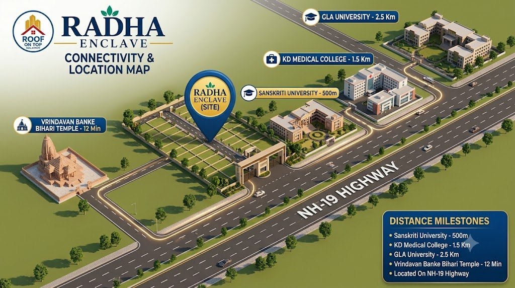
All distances and travel times below are supplied project particulars. Check routes, conditions and timing independently.
Delhi–Mathura–Agra six-lane national highway.
Opposite the project site on NH-19.
K.D. Medical & Dental College and Hospital · stated 3 minutes.
Chhata Railway Station and GL Bajaj College · stated 4 minutes.
Stated 5 minutes. The wider education cluster also includes Sanjay Engineering College, I.C.V.S. College, Excellence Group of Institutes, Dhanvantri Ayurvedic & Research Center Medical College, DPS Mathura and Chetak Academy.
Shri Banke Bihari Temple, ISKCON Temple, Prem Mandir, Chandrodaya Temple and Char Dham Temple.
Stated travel time; route and traffic can change actual journeys.
Goverdhan Parvat, Barsana, Nandgaon and Kokilavan Shani Dham Mandir are among the destinations with regional access.
Distances and travel times are indicative statements from project information and should not be treated as guaranteed journey durations.
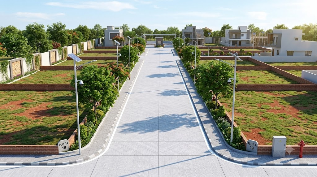
Sanskriti University is opposite the site; GLA University, GL Bajaj Group of Institutions and K.D. Medical College & Hospital are also listed in the surrounding education hub.
Such proximity can be a factor for buyers exploring student PG or hostel use, but it does not guarantee occupancy or rental yield. A real assessment should include local permissions, competing supply, build costs, operating expenses and current student housing demand.
Read the investor guide →Industrial presence can shape local housing needs. The names below are supplied as neighbourhood context, not as a promise of employment or appreciation.
Kosi Kalan Industrial Area is described as a manufacturing and logistics hub. Varun Beverages (Pepsi bottling plant), Usher Agrotech and Jindal Pipes are also cited among nearby industry.
A major regional industrial presence and employment anchor, as described in the supplied project information.
Milk and dairy industry activity adds to the mix of the region’s economy.
Proposed group housing and a shopping mall are also noted in supplied project information. Proposed developments are not assurances of delivery; confirm current status independently.
Project particulars describe regional access via the Yamuna Expressway and Delhi–Mumbai Expressway corridor, with stated times of 45 minutes to Noida International (Jewar) Airport and 35 minutes to the Proposed Film City.
These are supplied travel-time references, not assurances of current route conditions or future infrastructure delivery. Confirm the official status, route, timelines and actual travel distance before relying on them in an investment decision.
Review project details →Project-stated travel time via regional corridors. Verify route and current conditions.
Project-stated time to proposed development. Confirm official status and timeline.
Visit the site, check the routes and decide what matters to your plans.